This is a guest post written by Richard Higham. Richard is a Research fellow in the UCL Institute for Sustainable Heritage. His professional expertise spans commercial archaeology, academic archaeology, Heritage Science and GIS. After graduating with a first-class degree from the University of Brighton where, he then worked with Museum of London Archaeology as a field archaeologist before returning to academia to undertake a PhD. His PhD research at the University of Brighton focused on evaluating the evaluation systematic trenching strategies currently implemented in UK commercial archaeology. This PhD work was undertaken in collaboration with Historic England and Trent and Peak archaeology, as a SEAHA (an EPSRC funded researcher). He is also a visiting fellow at Cranfield University, currently working on Project ARKK, a field and laboratory initiative with the Georgian National Museum, which explores the intersection of social and technological change during Late Bronze and Early Iron Age (c.1500-500 BC).
Between 2018 and 2023 I undertook a PhD evaluating evaluation trenching in UK archaeology. I used ADS data derived from archaeological mitigation to simulate evaluation trenching layouts, testing trenching layouts and their capacity to detect archaeology across development areas. This work was made possible thanks to Historic England, Trent and Peak Archaeology, and Science and Engineering in Arts, Heritage and Archaeology (SEAHA), an EPSRC funded Centre for Doctoral Training under the supervision of Chris Carey, Matt Brolly, James Cole, Jane Corcoran and David Knight.
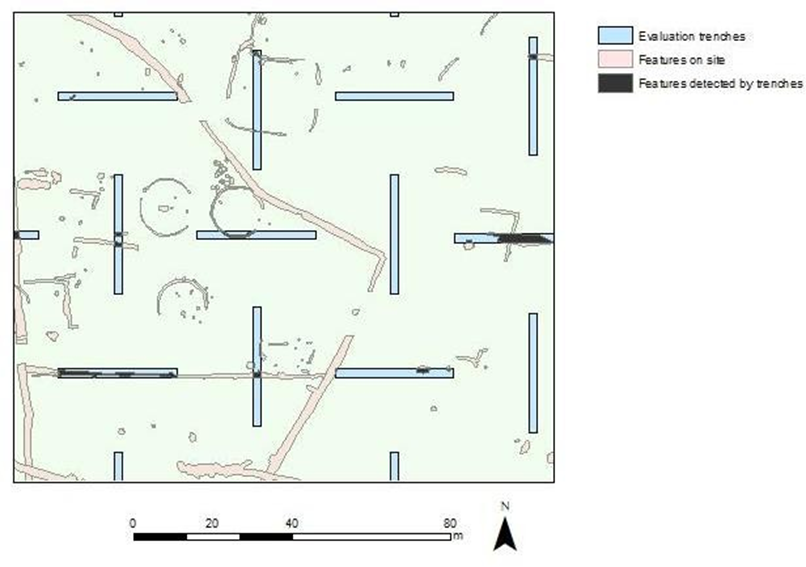
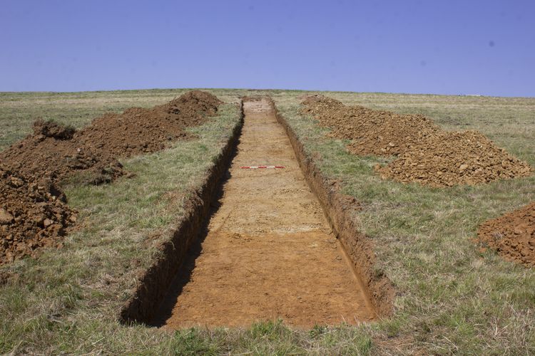
This project used the ADS to find case studies of archaeological mitigation sites as a proxy for archaeological landscapes. The modelling used Python and GIS to simulate trenching layouts at different percentage coverages over archaeological landscapes. The results provided a detailed analysis of how representative our evaluation data is of archaeological site populations. It provided insight into what archaeology our present evaluation practices are likely to be finding and, equally importantly, those that we might be likely to be missing.
The PhD demonstrated that some types and periods of archaeological features are likely to be overrepresented in evaluation data (e.g. large ditches), whilst others are likely to be missed (e.g. postholes, stakeholes, etc). Based on present trenching practice in England, the study found that there is likely to be an overrepresentation of more common Periods such as Post Medieval, whilst Periods such as Mesolithic may be underrepresented. These biases pose challenges in fully capturing the diversity and complexity of the past.
The study repeated 113,400 simulations of evaluations using 6 real site case study plans covering a combined 157 hectares and 14718 features (1-15% coverage repeated 420 times for each coverage from 1 to 15% in the layouts of Standard Grid, Herringbone and Continuous). It is the largest analysis of systematic evaluation trenching using simulations to date. These results were further supplemented by 324000 simulations over 9 hypothetical case studies which confirm the biases identified.
Evaluation trenching was found to be more reliable and more reflective of the archaeology on site when trenched above 10% coverage. One of the most salient results of the analysis was that the area of the features on site detected was proportionately related to the trenching percentage, i.e. it is a much better proxy of a sites archaeological population than the number of features detected.
The temptation moving forward is to have enough archaeological data to be able to reflect the variation of archaeological landscapes across the UK to best advise on trenching practice. Drawn in by the potential of assessing trenching using the vast archive of mitigation data in the ADS this project has continued. A new collaboration with William Walters Davis (software developer/data scientist) has produced a new Rust based model, which has the capability of comparing multiple trenching layouts using all the ADS case studies. Thanks to William’s hatred of inefficiency, coding nous and the ADS data available, this study has the potential to further our understanding of how effective the UK’s most commonly used archaeology evaluation method really is.